This is an old revision of the document!
Table of Contents
Micro Rain Radar
Principle
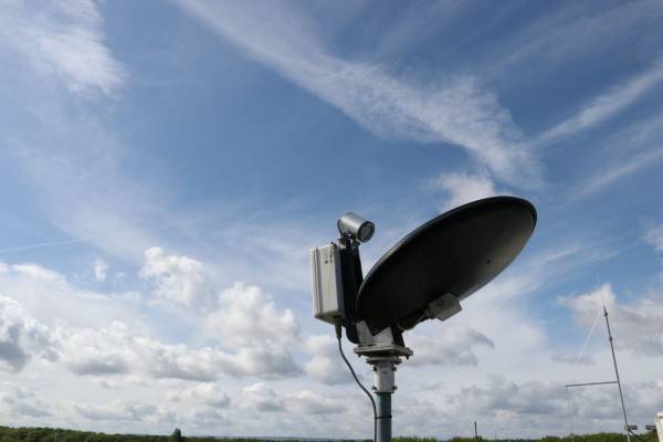
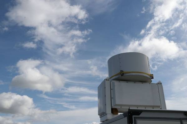
The Micro Rain Radar (MRR) is a vertical pointing FM-CW (frequency modulated –continuous wave) Doppler radar operating at 24.1 GHz (K-band, 12.4 mm wavelength). The emitted radar signal (only 50 mW transmitting power) is backscattered by falling hydrometeors (rain, graupel, snow). From the Doppler spectra the radar reflectivity factor (Ze) and the terminal fall velocity distribution can be derived.
In case of rain the Doppler spectra can be used to derive vertical profiles of microphysical rain properties like drop size distribution and rain rate.
The MRR system was also studied for its potential to observe snowfall (Kneifel et al., 2011). Also, an improved MRR algorithm most suitable for snowfall observations has been developed at IGMK (Maahn and Kollias, 2012). It is freely available on Github.
Measurement modes
- Vertically pointing observations with integration times from 10 to 3600 seconds.
- The range resolution can be varied from 10 to 200 m which determines together with the 30 range gates the system's maximum height range of 300 to 6000 m.
JOYCE-CF Standard Operation Procedures
- Temporal resolution 10 seconds
- Vertical resolution 35 meters (max. range = 1085 m)
Calibrations and data quality assurance procedures
- Check with co-located disdrometer to find out reflectivity offsets
- Consistency check with other cloud radars
Data availability
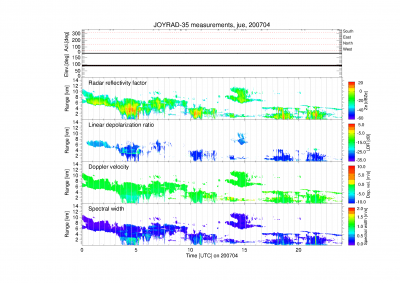
Some of the following data products are provided via Cloudnet ACTRIS cloudnet website with a temporal resolution of 30 seconds. If you would like to have additional data with better resolution or raw Doppler spectra please fill the data request sheet and send it to info@joyce.cloud
| Dataset | Temporal resolution | File size | Filename | Remarks |
|---|---|---|---|---|
| Radar reflectivity factor | 30 seconds | 1 file per day (30-50 MB) | YYYYMMDD_juelich_categorize.nc | available via Cloudnet |
| Doppler velocity | 30 seconds | 1 file per day (30-50 MB) | YYYYMMDD_juelich_categorize.nc | available via Cloudnet |
| Spectral width | 30 seconds | 1 file per day (30-50 MB) | YYYYMMDD_juelich_categorize.nc | available via Cloudnet |
| Linear depolarization ratio | 30 seconds | 1 file per day (30-50 MB) | YYYYMMDD_juelich_categorize.nc | available via Cloudnet |
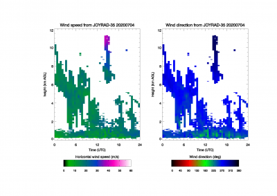
| Profiles of horizontal wind | 30 minutes | 1 file per day (30-50 MB) | YYYYMMDD_joyrad35_wind_profile.nc | |
| Radar moments | 2 seconds | variable size (up to 30 MB/hour in case of thick clouds) | YYYYMMDD_HHMM.mmclx.gz | zipped NetCDF file |
| Doppler spectra, Radar moments | 2 seconds | variable size (up to 2 GB/hour in case of thick clouds) | YYYYMMDD_HHMM.znc | NetCDF file |
| Doppler spectra | 2 seconds | variable size (up to 1 GB/hour in case of thick clouds) | YYYYMMDD_HHMM.zspc | Binary file |
- Dual-wavelength ratio Ka/X-Band and Ka/W-Band Link to Quicklooks
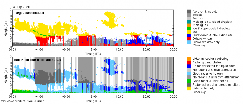
- Cloudnet target classification uses Radar moments data from JOYRAD-35. Combined with microwave radiometer and ceilometer observation, clouds are characterized by their geometrical extent as well as their microphysical properties.
Link to current observations
Data quicklooks can be found in the JOYCE quicklook archive and in the METEK archive
Measurement examples
JOYRAD-35 History
| Period | Place | Project |
|---|---|---|
| 2017 | Instrument upgrade | |
| 09/03/2012 - today | Research Center Jülich, Germany | JOYCE |
| 08/11/2011 - 08/03/2012 | Munich Airport, Germany | iPort campaign |
| 03/2011 - 07/11/2011 | Research Center Jülich, Germany | JOYCE |
Technical Specifications
| Parameter | Specification |
|---|---|
| Frequency | 24.1 GHz |
| Wavel | 12.4 mm |
| Radar Type | FM-CW |
| Transmit Power | 50 mW |
| Receiver | Single Polarization |
| Power consumption (radar) | 25 W |
| Total power cons. incl heating | 525 W |
| Max. range | 6 km |
| Range Resolution | 10-200 m |
| No. of range gates | 30 |
| Temporal resolution | 10 s |
| Antenna diameter | 0.5 m |
| Beam width (2-way, 6 dB) | 1.5° |
| Manufacturer | Metek |

